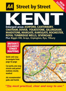
A new large format edition in the AA's ground breaking series of street atlases, covering Kent, now fully updated with a stylish new cover design. With an enlarged scale for city / town centres, this really is Britain's clearest street mapping. The atlas uses the latest digital data for Britain from Ordnance Survey and the AA and also includes National Grid Referencing as used by the emergency services. All of the maps clearly show recommended restaurants, hotels, one-way streets and car parks with 24-hour petrol stations ...
Read More
A new large format edition in the AA's ground breaking series of street atlases, covering Kent, now fully updated with a stylish new cover design. With an enlarged scale for city / town centres, this really is Britain's clearest street mapping. The atlas uses the latest digital data for Britain from Ordnance Survey and the AA and also includes National Grid Referencing as used by the emergency services. All of the maps clearly show recommended restaurants, hotels, one-way streets and car parks with 24-hour petrol stations now highlighted. Featuring a clever use of colour to ensure they can be read under street lighting, these maps are all you need to keep you on the move.
Read Less
Add this copy of Maxi (Aa Street By Street) to cart. $5.32, fair condition, Sold by SELL BOOKS LTD rated 5.0 out of 5 stars, ships from London, LONDON, UNITED KINGDOM, published 2005 by Automobile Association.
Choose your shipping method in Checkout. Costs may vary based on destination.
Seller's Description:
Fair. Please see the condition note after this for details, if this is missing please consider Acceptable to mean poor quality that could include major staining, water damage, writing, missing dustjacket, etc etc. Our books are dispatched from a Yorkshire former cotton mill. We list via barcode/ISBN so please note that the images are stock images and may not be the exact copy you receive, furthermore the details about edition and year might not be accurate as many publishers reuse the same ISBN for.