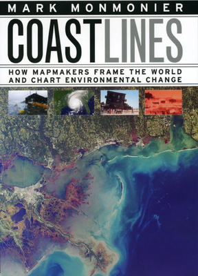
In the next century, sea levels are predicted to rise at unprecedented rates, causing flooding around the world, from the islands of Malaysia and the canals of Venice to the coasts of Florida and California. These rising water levels pose serious challenges to all aspects of coastal existence--chiefly economic, residential, and environmental--as well as to the cartographic definition and mapping of coasts. It is this facet of coastal life that Mark Monmonier tackles in Coast Lines . Setting sail on a journey across ...
Read More
In the next century, sea levels are predicted to rise at unprecedented rates, causing flooding around the world, from the islands of Malaysia and the canals of Venice to the coasts of Florida and California. These rising water levels pose serious challenges to all aspects of coastal existence--chiefly economic, residential, and environmental--as well as to the cartographic definition and mapping of coasts. It is this facet of coastal life that Mark Monmonier tackles in Coast Lines . Setting sail on a journey across shifting landscapes, cartographic technology, and climate change, Monmonier reveals that coastlines are as much a set of ideas, assumptions, and societal beliefs as they are solid black lines on maps. Whether for sailing charts or property maps, Monmonier shows, coastlines challenge mapmakers to capture on paper a highly irregular land-water boundary perturbed by tides and storms and complicated by rocks, wrecks, and shoals. Coast Lines is peppered with captivating anecdotes about the frustrating effort to expunge fictitious islands from nautical charts, the tricky measurement of a coastline's length, and the contentious notions of beachfront property and public access. Combing maritime history and the history of technology, Coast Lines charts the historical progression from offshore sketches to satellite images and explores the societal impact of coastal cartography on everything from global warming to homeland security. Returning to the form of his celebrated Air Apparent , Monmonier ably renders the topic of coastal cartography accessible to both general readers and historians of science, technology, and maritime studies. In the post-Katrina era, when the map of entire regions can be redrawn by a single natural event, the issues he raises are more important than ever.
Read Less
Add this copy of Coast Lines: How Mapmakers Frame the World and Chart to cart. $19.82, good condition, Sold by Phatpocket Limited rated 5.0 out of 5 stars, ships from Waltham Abbey, ESSEX, UNITED KINGDOM, published 2008 by University of Chicago Press.
Choose your shipping method in Checkout. Costs may vary based on destination.
Seller's Description:
Good. Ships from UK in 48 hours or less (usually same day). Your purchase helps support Sri Lankan Children's Charity 'The Rainbow Centre'. Ex-library, so some stamps and wear, but in good overall condition. 100% money back guarantee. We are a world class secondhand bookstore based in Hertfordshire, United Kingdom and specialize in high quality textbooks across an enormous variety of subjects. We aim to provide a vast range of textbooks, rare and collectible books at a great price. Our donations to The Rainbow Centre have helped provide an education and a safe haven to hundreds of children who live in appalling conditions. We provide a 100% money back guarantee and are dedicated to providing our customers with the highest standards of service in the bookselling industry.
Add this copy of Coast Lines to cart. $54.89, new condition, Sold by Kennys.ie rated 5.0 out of 5 stars, ships from Galway, IRELAND, published 2008 by University of Chicago Press.
Choose your shipping method in Checkout. Costs may vary based on destination.
Seller's Description:
New. Covering shifting landscapes, cartographic technology, and climate change, this book reveals that coastlines are as much a set of ideas, assumptions, and societal beliefs as they are solid black lines on maps. It charts the historical progression from offshore sketches to satellite images. Num Pages: 224 pages, 85 halftones. BIC Classification: WTRM. Category: (P) Professional & Vocational. Dimension: 233 x 163 x 19. Weight in Grams: 462. 2008. Hardback.....We ship daily from our Bookshop.
Add this copy of Coast Lines: How Mapmakers Frame the World and Chart to cart. $12.71, good condition, Sold by BookResQ. rated 5.0 out of 5 stars, ships from West Valley, UT, UNITED STATES, published 2008 by University of Chicago Press.
Add this copy of Coast Lines: How Mapmakers Frame the World and Chart to cart. $22.55, good condition, Sold by SurplusTextSeller rated 5.0 out of 5 stars, ships from Columbia, MO, UNITED STATES, published 2008 by University of Chicago Press.
Choose your shipping method in Checkout. Costs may vary based on destination.
Seller's Description:
Good. Ships in a BOX from Central Missouri! May not include working access code. Will not include dust jacket. Has used sticker(s) and some writing or highlighting. UPS shipping for most packages, (Priority Mail for AK/HI/APO/PO Boxes).
Add this copy of Coast Lines Format: Hardcover to cart. $31.31, new condition, Sold by indoo rated 5.0 out of 5 stars, ships from Avenel, NJ, UNITED STATES, published 2008 by University of Chicago Press.
Add this copy of Coast Lines: How Mapmakers Frame the World and Chart to cart. $105.50, new condition, Sold by GridFreed rated 5.0 out of 5 stars, ships from San Diego, CA, UNITED STATES, published 2008 by University of Chicago Press.