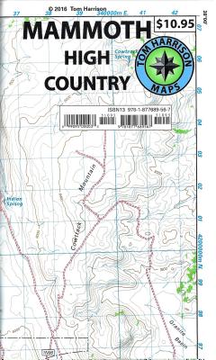
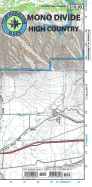
Shaded relief topo map. Scale:1:63,360, (1 inch represents one actual mile), 2005 Printed on waterproof and tear proof material. Mammoth High Country area is one of the most popular getaway and outdoors activity areas in California. Coverage on this map includes, Minarets, June Lake, Ritter Range, Convict Lake, Mono Craters, Devils Postpile, Mammoth Lakes, Agnew Meadows, Thousand Island Lake.
Read More
Shaded relief topo map. Scale:1:63,360, (1 inch represents one actual mile), 2005 Printed on waterproof and tear proof material. Mammoth High Country area is one of the most popular getaway and outdoors activity areas in California. Coverage on this map includes, Minarets, June Lake, Ritter Range, Convict Lake, Mono Craters, Devils Postpile, Mammoth Lakes, Agnew Meadows, Thousand Island Lake.
Read Less
Add this copy of Mammoth High Country: Trail Map to cart. $16.29, very good condition, Sold by Bingo Used Books rated 5.0 out of 5 stars, ships from Vancouver, WA, UNITED STATES, published 1996 by Harrison (Tom)-Cartography, U.S..
Add this copy of Mammoth High Country Trail Map: Waterproof, Tearproof to cart. $17.00, very good condition, Sold by Browsers' Bookstore rated 5.0 out of 5 stars, ships from Albany, OR, UNITED STATES, published 2021 by Tom Harrison Maps.